- Thumbnail
- Resource ID
- 809f099b-9d22-11e9-8d7d-000d3ab6a624
- Title
- Archipelagic Waters (V2)
- Date
- July 2, 2019, 6:38 p.m., Publication
- Abstract
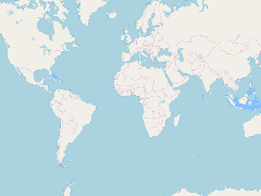
- Version 2 of the Archipelagic Waters from the VLIZ Maritime Boundaries Geodatabase. Archipelagic Waters are waters falling within archipelagic baselines.
- Edition
- --
- Owner
- gridanode
- Point of Contact
- devrsgis@gmail.com
- Purpose
- --
- Maintenance Frequency
- None
- Type
- not filled
- Restrictions
- None
- None
- License
- None
- Language
- eng
- Temporal Extent
- Start
- --
- End
- --
- Supplemental Information
- No information provided
- Data Quality
- --
- Extent
-
- long min: -181.8000030518
- long max: 181.8000183105
- lat min: -21.2698402405
- lat max: 27.5144920349
- Spatial Reference System Identifier
- EPSG:900913
- Keywords
- no keywords
- Category
- None